
RCDroidBox - Map Markers
Version 1.0.9.61 and onwards allowes for placing and management of markers in Map. Depending on the number of markers placed, their functionality varies:
- One Marker - Application will display distance from plane to this marker.
- Two Markers - A strip is created. Application will sound when plane is near the edge of the strip
- More Markers - A polygon with corners defined by markers is defined. Model is "allowed" to fly only within this polygon. RCDB will sound a warning when model reaches edge of polygon. Another warning will sound when model leaves the designated polygon completely..
Placing a single marker on map
Touch and hold on a position where you want to place the marker. If GPS data are available, the application will immediately display distance to the marker. Also, a new "virtual" sensor Marker Distance is created. This can be assigned to any of the textboxes and/or it can even be voice reported.
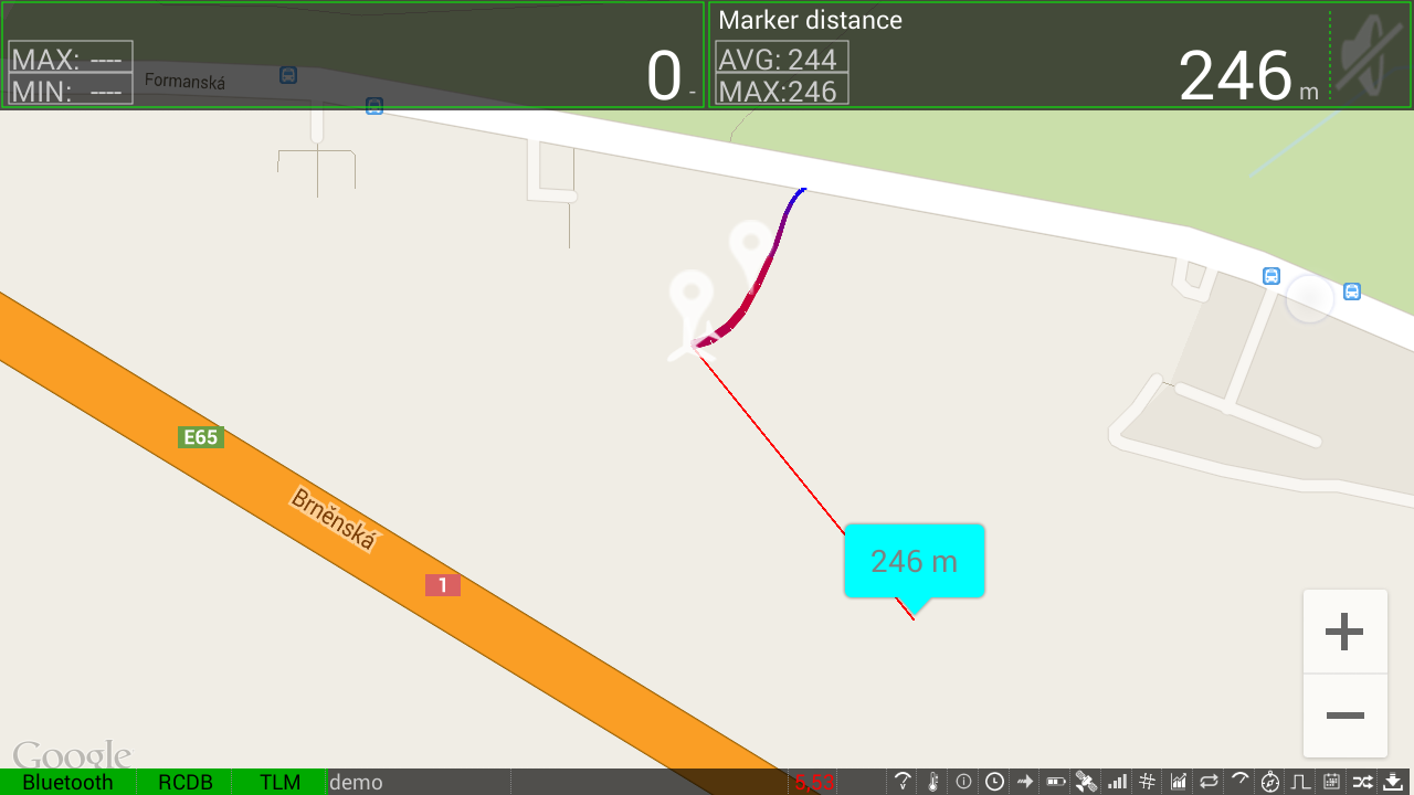
One Marker
Placing two markers on the map
First marker is created same as in the example above. Placing a second marker defines a line passing through both of them. A second, parallel line is automatically created. The distance of this line can by adjusted. Click the line, it will be highlighted, touch and drag it to desired distance. The actual distance is displayed in a bubble as the line is dragged.
The area defined by those 2 parallel lines is used a a flying area. When model reached close to the edge, two short beeps will sound. When model leaves the defined area, two long beeps will sound.
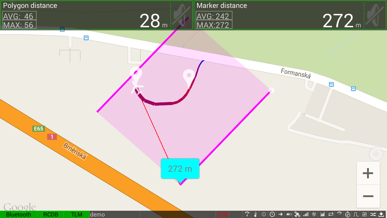
Two Markers
Placing multiple markers on the map
Markers are created similarly to the two previous examples. when third marker is placed, a polygon is formed. Same rules as when flying in rectangle applies. Reaching close to polygon edge ... "beep beep", leaving polygon completely ... "beeeep beeeep".
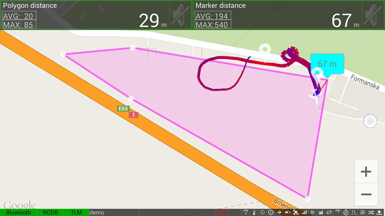
Polygon
Editing Markers
With connected telemetry, it is possible to edit marker position. Tap on the marker you want to edit. It will be highlighted (see picture). Hold the marker for a short while and them you can move it to desired position.
Marker Edit
Deleting Markers
With connected telemetry, it is possible only to delete all markers using menu/Delete all markers.
Marker Administration
Markers are stored in database of the connected model. They can be administered in menu Models/
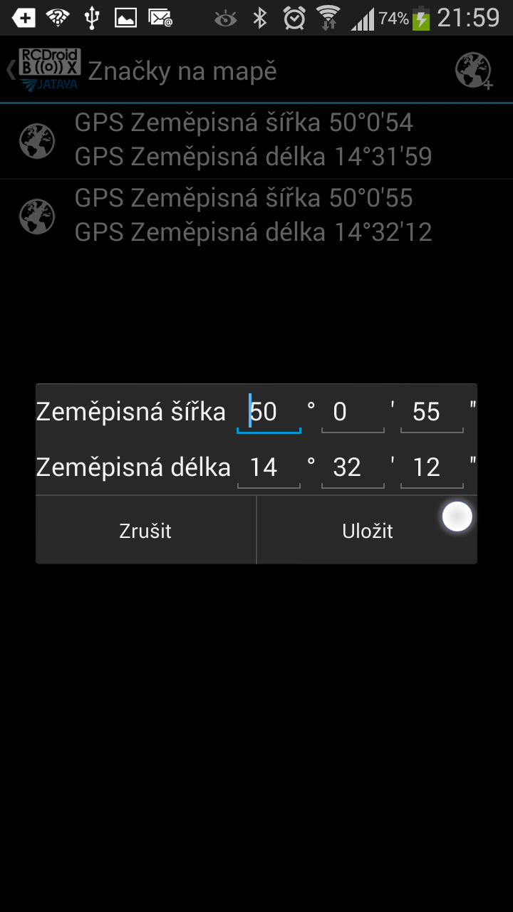
Marker administration
Marker behavior
It is possible to define behavior of the markers in the application settings/GPS menu.
The following settings are available:
- "Circuit distance" : Defines distance of the two parallel lines for are dafined by 2 markers.
- "Alert distance" Define how far from the edge of a polygon will the warning sound.
This is the first version of application allowing users to define markers in the map. This functionality will be further refined and improved in the coming versions.
Current version crashes when user tries to add marker before model GPS location is known. This will be fixed in a new app release. This release is is coming quite soon.
English